0800 1707411
Nationwide, based in Cambridgeshire


Integrated Solutions for a Safer, Smarter World
From energy infrastructure and drone surveillance to ecology, heat loss, and roof/facade surveys — Redwood delivers highly efficient drone-led services across the UK. Explore how our expert teams use advanced tech, real-world experience, and a one-team approach to protect, inspect, and enhance your assets.
ENERGY INFRASTRUCTURE
SECURITY & SURVEILLANCE
BUILT ENVIRONMENT
At the forefront of energy infrastructure and renewable management, we offer comprehensive survey services utilizing cutting-edge technology like thermal imaging and drone inspections.
Whether inspecting solar parks, underground water mains, or powerlines, our services are specifically designed to ensure operational efficiency and system integrity.

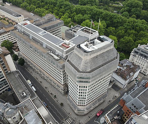
Our aerial surveillance service combines high-resolution visual feeds and thermal imaging to deliver unmatched event situational awareness. Designed for real-time response and post-event accountability, we support festivals, corporate events, universities, and high-footfall public gatherings with live monitoring, persistent tracking, and coordinated response from above.

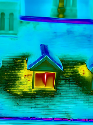
Our offering includes thermal imaging, 3D modelling, photogrammetry, and high-resolution drone inspections. Whether you're identifying hidden leaks, assessing heat loss, capturing structural detail, or monitoring roof condition, we provide fast, accurate data to support clear decisions across residential, commercial, and public sector properties.
NEW VIDEO: See Event Drone Surveillance in Action
View Our Top Services

Event Drone Surveillance
Drone surveillance delivers faster response times, greater coverage, and clearer insights — without the need for additional manpower or fixed infrastructure. Whether you’re securing a festival site, a private venue, or a university campus, aerial systems increase your operational efficiency and reduce risk on the ground.


Thermal & Condition Surveys
We provide professional thermal and high-resolution visual drone inspections for leak detection, heat loss mapping, and structural condition reporting. Ideal for identifying building issues non-invasively, saving time and cost across commercial and residential properties.
_edited.jpg)

Working With the Best Clients and Partners


.png)

